-
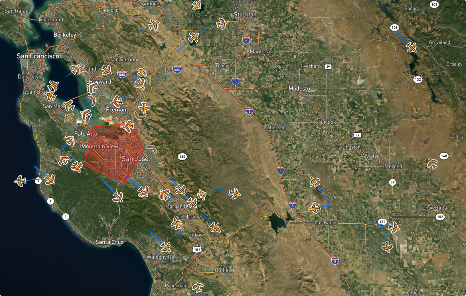
Ground Radar and ADS-B for BVLOS Operations
Validating a ground radar's accuracy and its importance for BVLOS drone operations
-
Photogrammetry with Google Earth Studio
Simulating drone imagery with Google Earth Studio and generating a 3D model with RealityCapture

-
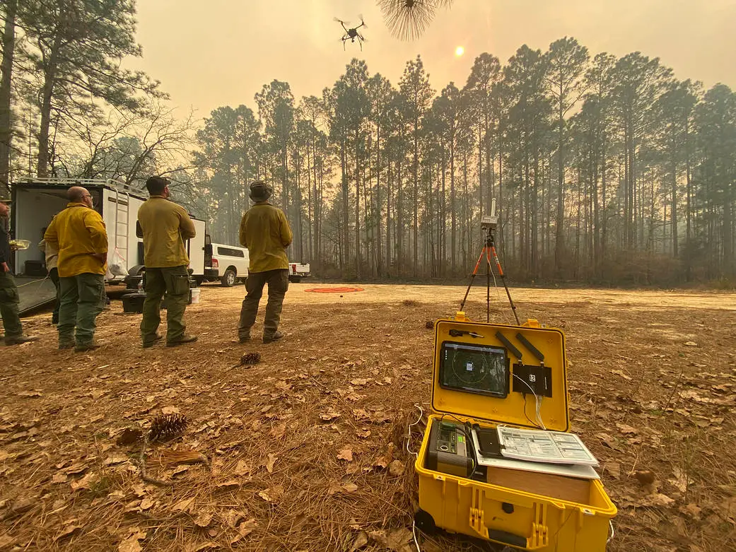
Integrating Drones into Wildfire Fighting
Exploring how drone technologies and NASA’s ACERO initiative can enhance wildfire response.
-
Space and Aerospace Websites to Check Out
A collection of websites related to space and aerospace.
-
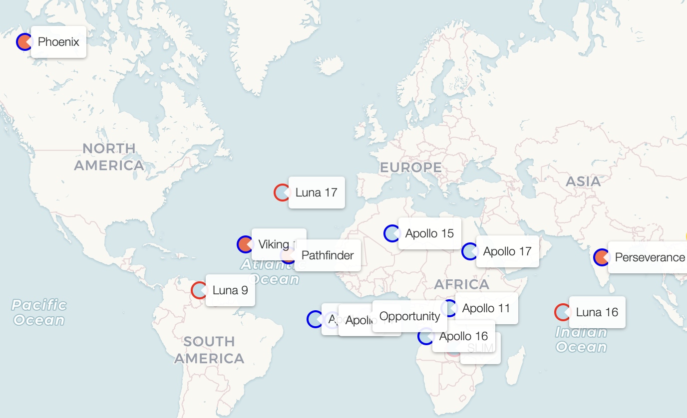
Moon and Mars Landings
Visualizing Moon and Mars Landing Locations.